

While Scottsdale boasts hundreds of miles of hiking trails, most visitors will only have time to sample a few. So, they’ll want the best.
Here they are. These 7 incredible hiking trails range from easy to challenging with each offering something special. Here are the best scenic views, the most intriguing geological formations, captivating cacti, and memorable wildflower displays. These are the Magnificent 7, the best hiking trails you can find in Scottsdale.
Balanced Rock
McDowell Sonoran Preserve – Granite Mountain Trailhead
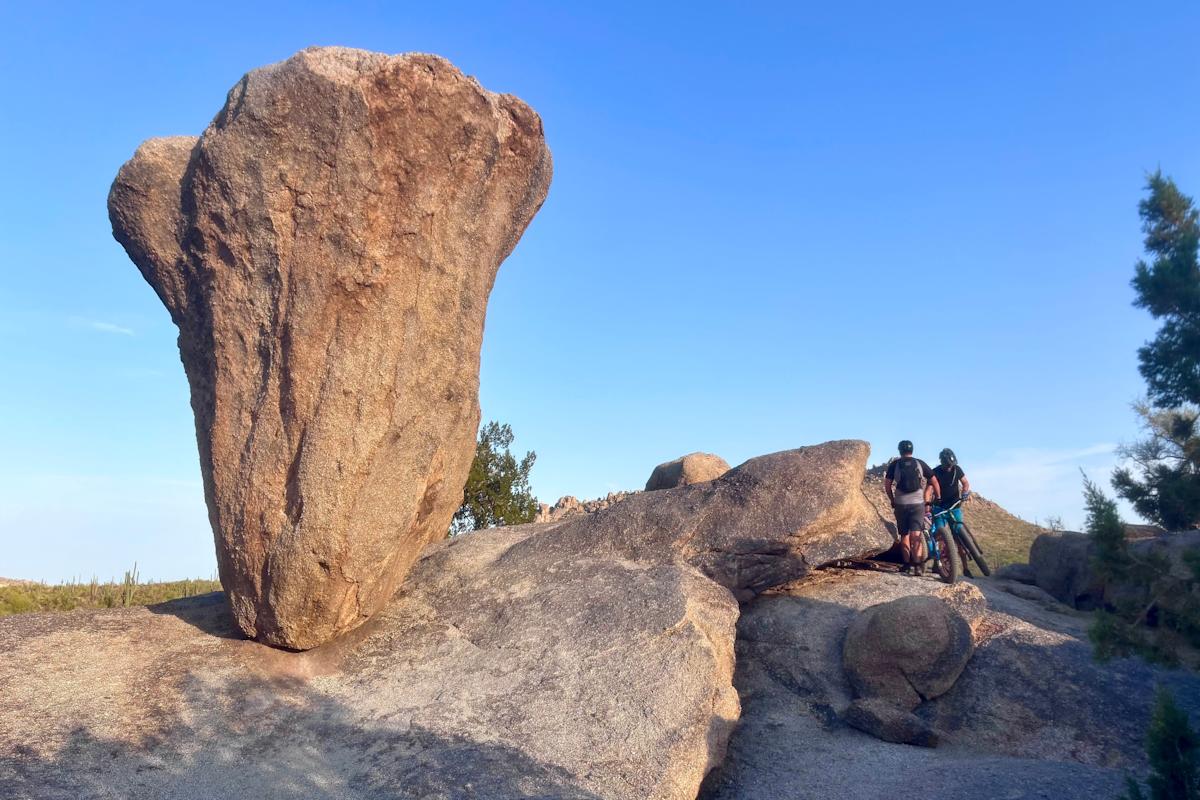
The McDowell Mountains snarl with granite teeth. Flashing such an array of boulders means intriguing formations are found throughout the Preserve. The precarious monolith of Balanced Rock may be the most inspirational. After so many years exposed to the elements, Balanced Rock shouldn’t still be upright. The same goes for me yet we’re both still hanging in there. Resembling a giant troll molar, the big formation is often included as a side trip on longer hikes. But this rock star deserves to be a destination, not just a detour. From Granite Mountain Trailhead, create a scenic 4.4-mile out-and-back route along the southern edge of Granite Mountain by using pieces of Bootlegger, Saddlehorn, Granite Mountain Loop, and Balanced Rock trails.
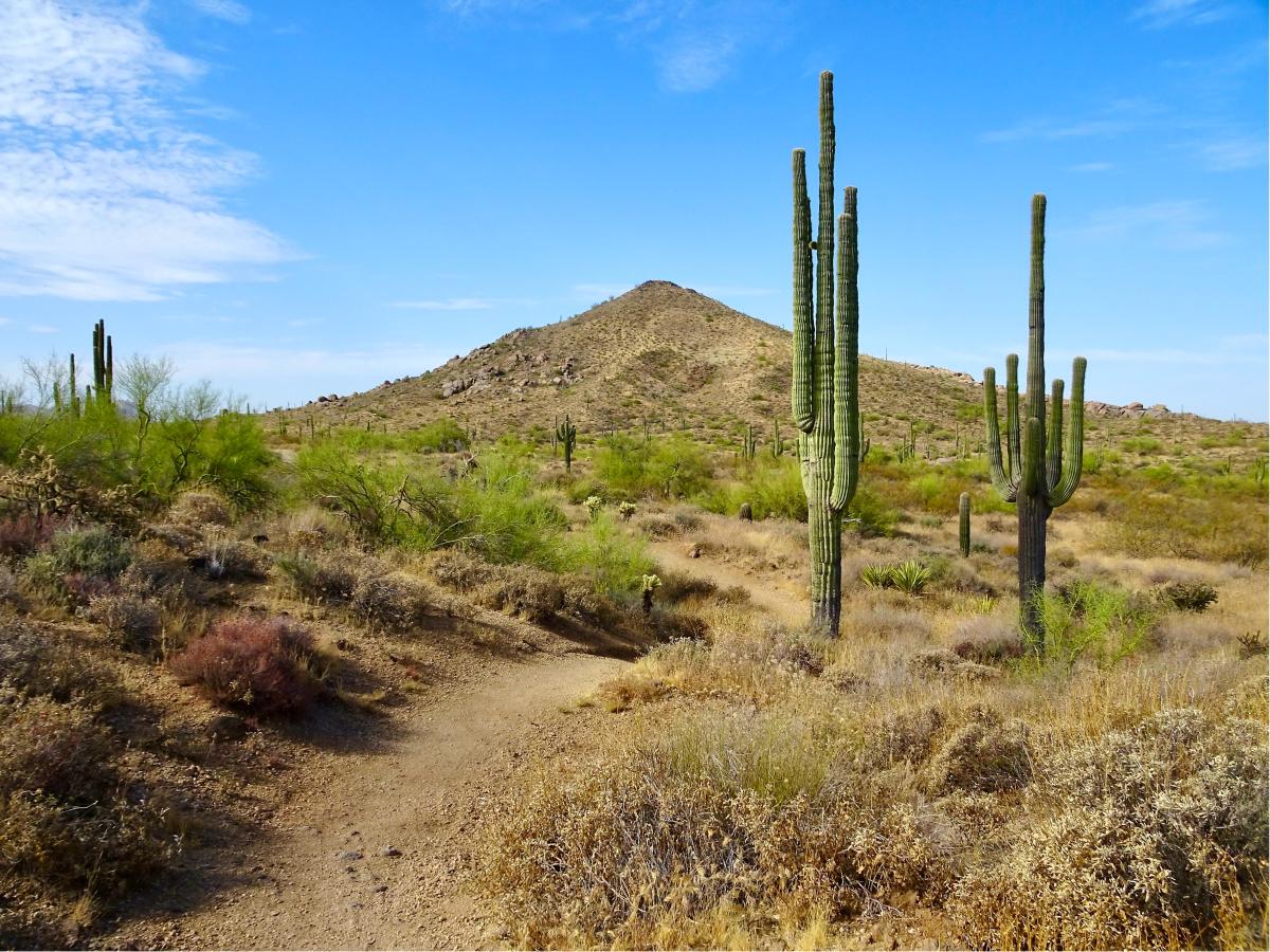
Axle Grease Trail
McDowell Sonoran Preserve – Pima-Dynamite Trailhead
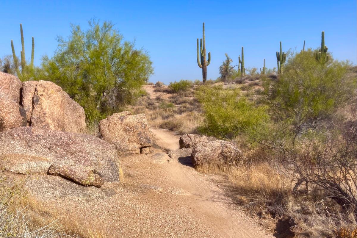
Axle Grease almost makes me consider hopping on a mountain bike. Smooth and flowy with a series of dips, curves and curls, it must be a blast to ride. But also, great fun on foot. From the Pima-Dynamite Trailhead, Axle Grease tracks north, following a broad wash and carving a route through one of the most impressive stands of saguaros in the Preserve. Groupings of the lean giants cluster along the trail. Axle Grease goes for 4.5 miles tracing the edge of the Preserve so it’s a long out-and-back. But interconnected hiking trails make it easy to create shorter loops.
Go John Trail
Cave Creek Regional Park
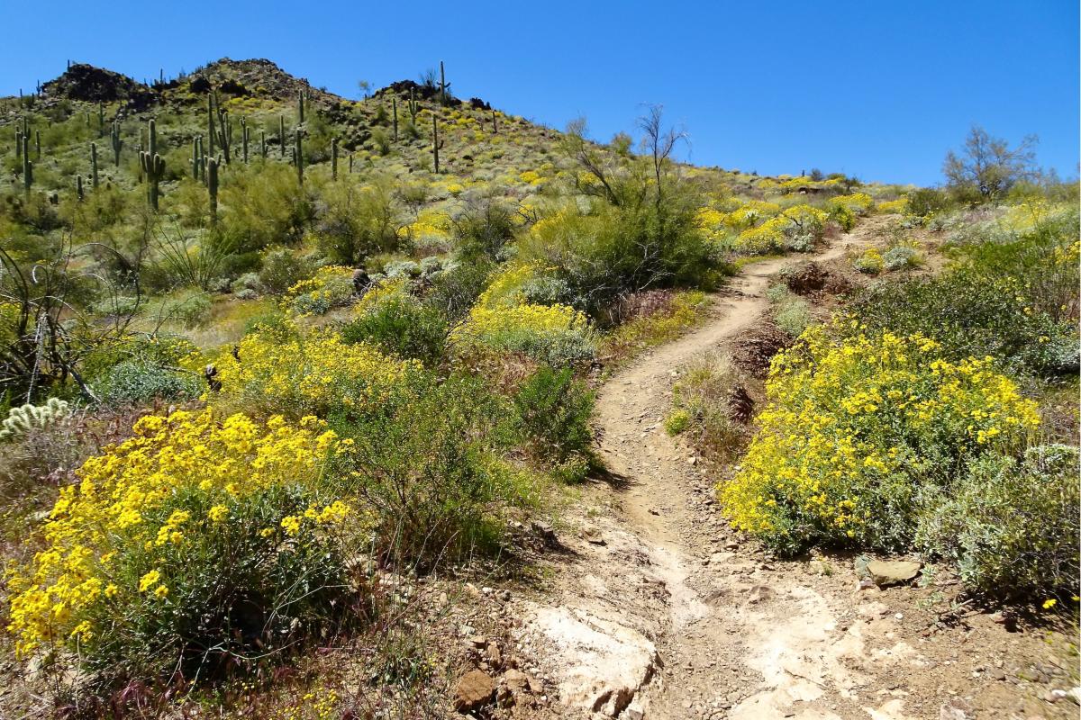
There is something wild and remote about Go John Trail, a centerpiece of Cave Creek Regional Park. This hiking trail retains such an unspoiled Western feel that whenever I scramble through Gunsight Pass, I check for a posse on my backtrail. The moderate 5.8-mile loop crosses cactus-covered hills with scenery that features panoramas of distant mountains mixed with intriguing rock formations close by. And in spring, Go John is absolutely swimming in wildflowers.
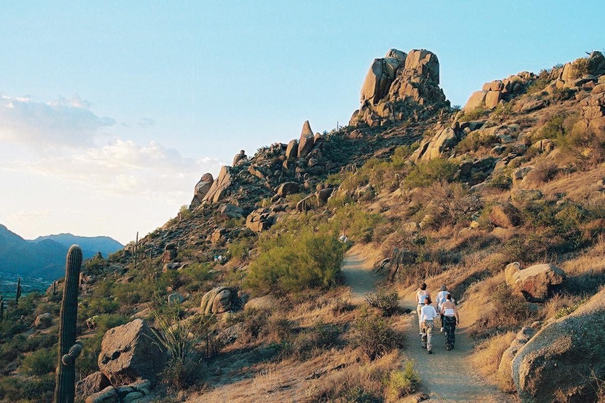
Tom’s Thumb
McDowell Sonoran Preserve – Tom’s Thumb Trailhead
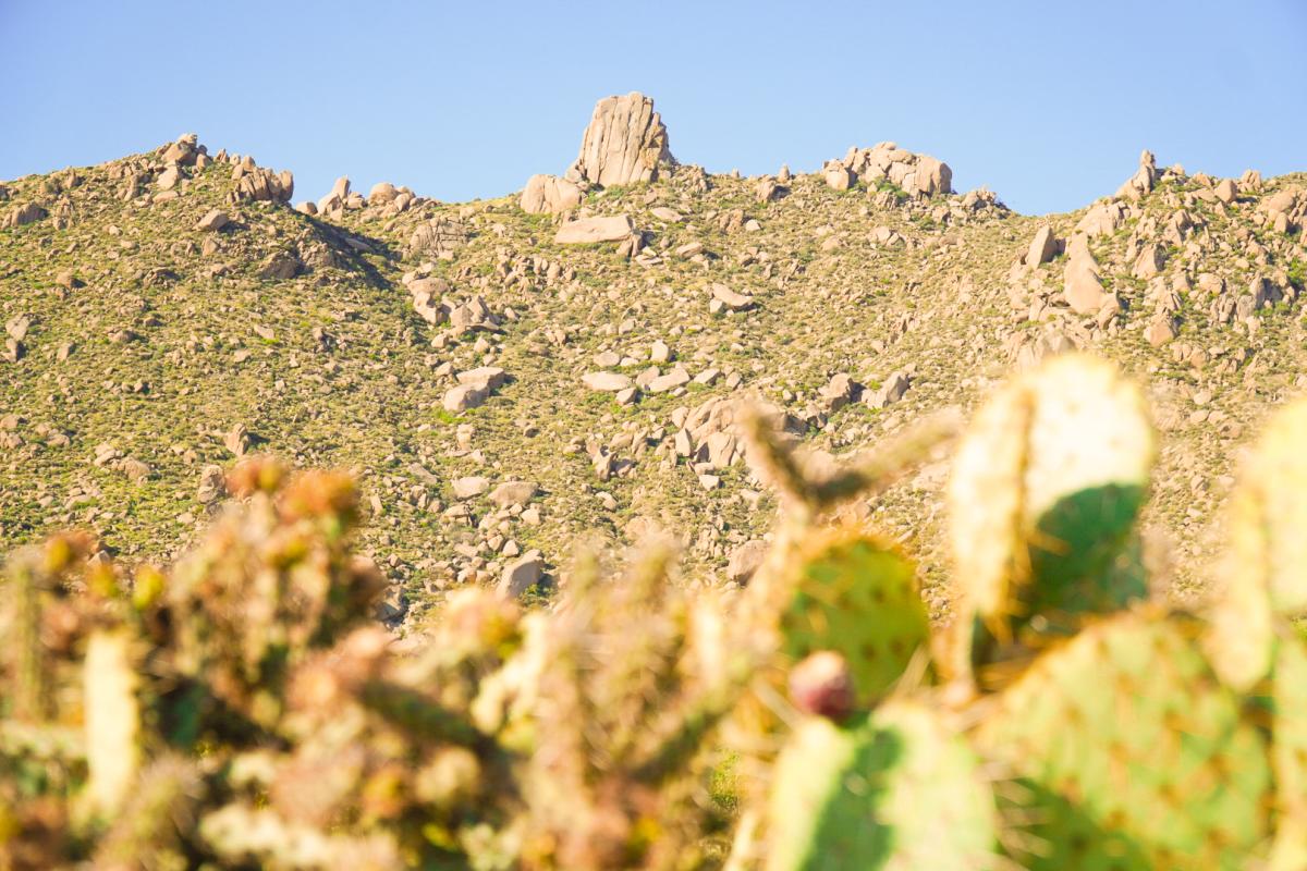
Capping a high ridge in the McDowell Mountains, Tom’s Thumb is a cloud-spearing thrust of stone reached by a 4.6-mile round-trip hike. The trail to this rock skyscraper is fiercely steep. From Tom’s Thumb Trailhead, expect to gain more than 1,300 feet of elevation in just 2.5 miles. The heart of this quadrant is adorned with a lavish garden of toppled and tilted boulders. Views are spectacular. But they’re nothing compared to the sense of accomplishment you’ll feel standing at the base of the towering Thumb. That’s the joy of hiking.
Cone Mountain Loop
McDowell Sonoran Preserve – Brown’s Ranch Trailhead
No mistaking Cone Mountain, the standalone peak with the sloping shoulders of a rainbow trout. An easy 4.1-mile hike throws a lasso around Cone, and rambles through open country dotted with saguaros. Starting from Brown’s Ranch Trailhead, angle northwest on Upper Ranch Trail, to the junction with Cone Mountain Trail. Follow Cone Mountain as it wraps around the peak. On the backside, slabs of stone add texture to the rolling terrain. Reconnect with Upper Ranch and meander back to the trailhead.
Latigo-Sidewinder Loop
McDowell Sonoran Preserve – Pima-Dynamite Trailhead

Crested saguaros are the unicorns of the Sonoran Desert—rare, exotic, and beautiful. This easy 2.7-mile loop guides you to one of the most spectacular. From Pima Dynamite Trailhead, start on smooth Latigo Trail, then bear right on Sidewinder Trail aiming toward a boulder-crowned ridge. Standing guard is an elegant crested saguaro. The tall cactus trunk spreads into a classic fan-shape, a giant meaty flower, like something you’d find growing in Jurassic Park. A slight detour scrambles up behind the rocks to Sidewinder Overlook for nice vistas. Jump back on Latigo and return to the trailhead.
Pinnacle Peak Summit Trail
Pinnacle Peak Park
Rounding out our lists of the best hikes in Scottsdale, is Pinnacle Peak Trail. There’s a siren song to Pinnacle Peak, luring crowds to its stony flanks. This is the most popular trail in Scottsdale because it offers everything you want in a hike. The path features a firm smooth surface with enough dips and rises to provide a workout, all amid classic desert vegetation and lavish panoramas. Pinnacle Peak is the celebrity of Scottsdale’s skyline, visible for miles around. It perches on a ridge like a stone rocket sitting on the launchpad. Admire it coming and going on this out-and-back hike totaling 4 miles.