The Arizona desert beats with a fierce heart. It is a land of endless sunshine where the plants come armed with small knives. Scottsdale is part of that haunting terrain known as the Sonoran Desert, the only place on earth where forests of the majestic saguaro cactus spear the clouds with upraised arms. This land is best explored on foot, moving slow and quiet amid rare scenic beauty and wide-open spaces.
What are you waiting for? No experience is needed. Even novice hikers are welcome thanks to an abundance of short, easy, and well-marked trails. Here are four bite-sized adventures that almost anyone can enjoy. Consider this an introduction to the desert. These easy Scottsdale hikes will seduce you and leave you longing for more.
Gateway Trailhead – Horseshoe Loop
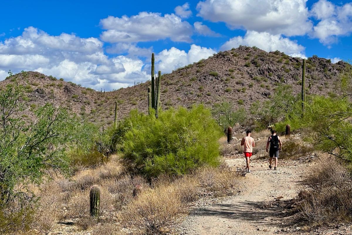
Consider this a perfect beginner’s hike because it never strays far from civilization yet showcases a splendid example of classic Sonoran Desert scenery. It’s located in the McDowell Sonoran Preserve, the crown jewel of Scottsdale’s unforgettable backyard, and starts from the easily-accessible Gateway Trailhead. Just before reaching the entry structure, turn left onto Desert Park Trail, which angles north offering distant neighborhood views.
In 0.4 miles, turn right onto Horseshoe Trail as it crosses a rocky bajada. Enjoy the impressive blend of desert plants that includes saguaro, cholla, and creosote. The palo verde and ironwood trees provide habitat for a wide range of birds likely to serenade you on your walk as you approach the foothills of the McDowell Mountains. Turn right on Gateway Trail as it dips across a small drainage with impressive vistas all around.
When you reach the Saguaro Trail, a right turn will lead you back to the trailhead. But you also have the option of turning left on Saguaro, which makes a quick 0.3-mile loop at the base of the hills. All told, the hike is 1.7 miles total, or 2 miles with the optional Saguaro Loop.
Tom’s Thumb Trailhead – Feldspar Loop
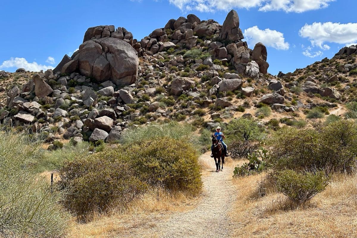
It’s all about texture on this side of the McDowell Sonoran Preserve where this short loop highlights the rough bones of these mountains. Exposed boulders have been gnawed and shaped by the elements. They lie scattered across fields and stacked in great piles. Silent geological drama plays out all around this walk.
Start on the Tom’s Thumb Trail that charts a rolling course toward a prominent rock thrust poking up from a ridgeline overhead. But don’t worry. The steep ascent to Tom’s Thumb can wait for another day. Instead turn left on Feldspar Trail after a half-mile. Now the fun begins. The Feldspar drops gently while also skirting along the base of the hills crowned by a cascade of boulders. This is where rock climbers come to test their skills so keep an eye peeled for any that might be scaling the jumbled cliffs like Spiderman on vacation.
The Feldspar ends at the junction with Marcus Landslide Trail, which, with a right turn leads to more intriguing geological history. Another outing to remember for a different day. Turn left back to the trailhead for a 1.5-mile loop.
Fraesfield Trailhead – Camino Campana Interpretive Trail
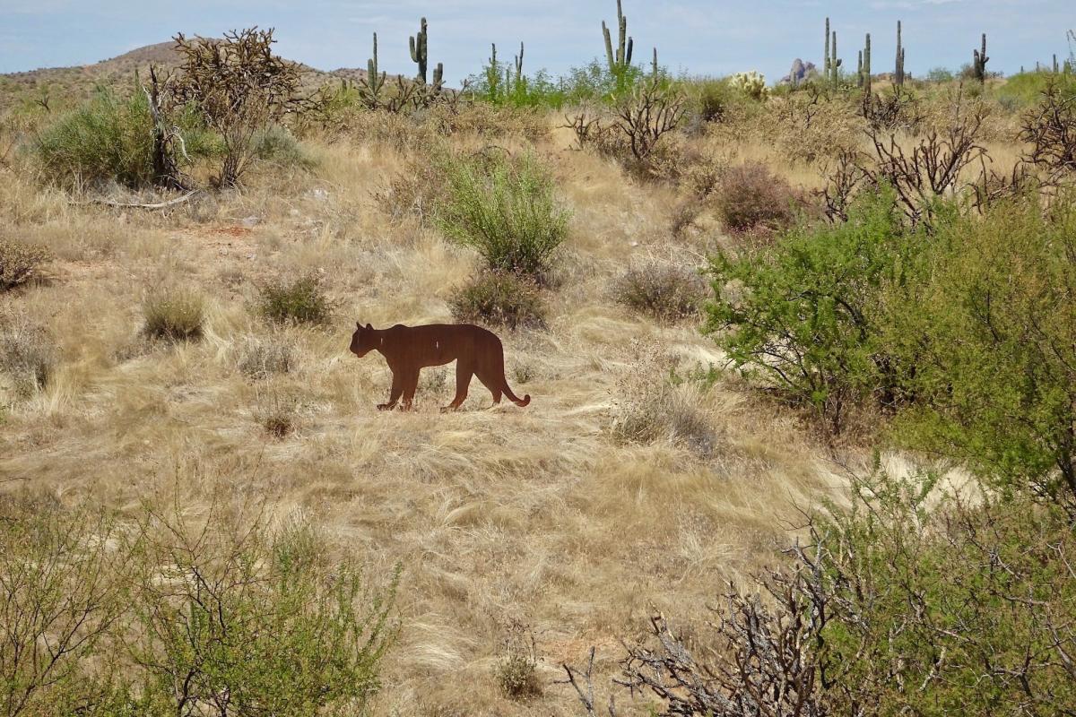
In an effort to provide access to the desert landscape, the McDowell Sonoran Preserve features multiple trails that are ADA accessible. Each includes interpretive signage full of information about nature, history, and geology—turning them into slender open-air classrooms. Camino Campana, the newest of these, loops through the desert grasslands at the base of Fraesfield Mountain offering 13 stops along the way marked by illustrated signs and other displays.
Just under a mile long, the barrier-free path is named for Kathryn “Sam” Campana, a former Scottsdale mayor and tireless advocate for environmental issues, who was instrumental in the creation of the preserve. Departing from Fraesfield Trailhead, the wide smooth trail stabilized with decomposed granite can be enjoyed by just about anyone, including people using wheelchairs and families pushing strollers. Don’t jump out of your skin if you spy a mountain lion slinking through the scrub. A realistic metal silhouette is one of the exhibits. There’s even a selfie station with Four Peaks as backdrop. Along the way, hikers will learn about plants, wildlife, and geology of the surrounding desert. The more you learn, the more fascinating the desert becomes.
McDowell Mountain Regional Park – Wagner Trail
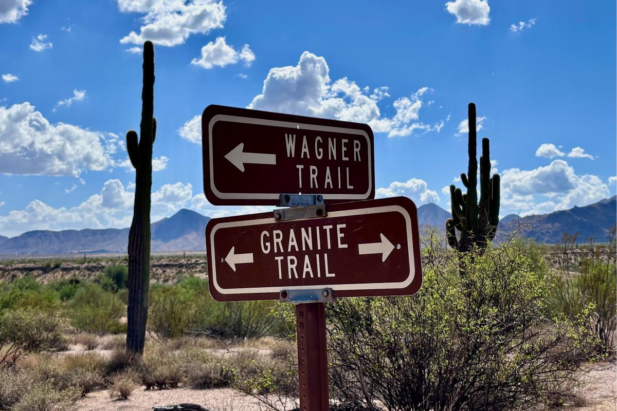
Tucked away in McDowell Mountain Regional Park, which is on the east side of the McDowell Mountains, the Wagner Trail presents a different side of the desert experience. You’ll see only a smattering of saguaros here. Instead, this peaceful out-and-back hike departs from the campground and cuts across open country that supports a healthy population of creosote, jojoba, and triangle-leaf bursage. It all turns surprising green, especially following winter rains.
The Wagner Trail shows off a vast sweep of wide-open spaces with the horizons shoved wide and a big sky pressing down. You’ll hike westward for 1.1 miles gazing toward the McDowells. The Wagner ends at the junction with Granite Trail. When you turn and start back, range upon range of mountains beckons. Look for Four Peaks etched along the skyline. Sharp-eyed hikers may also spot Weaver’s Needle and the Flatiron, part of the Superstition Mountains. Trail total is 2.2 miles round-trip. Or if you prefer making a loop, turn left on Granite Trail, which will guide you back to the other side of the campground. You can walk the road back to your vehicle.